
Earth and Space Sciences – Creating a remote Field Experience
May 4, 2020
The Department of Earth and Space Sciences uses Tech Fee equipment in almost every geology course offer. This semester, Dr. Martin Helmke taught ESS
480/580 Engineering Geology, a course that trains geology students how to investigate natural hazards and support engineering projects. Fundamental course concepts included surveying, spatial analysis, and drone photogrammetry.
 Although the field portion of the course was dropped due to the COVID-19 pandemic,
Dr. Helmke was able to train students on the use of cutting-edge technology provided
through Tech Fee. Using a combination of a Go-Pro camera and a remote Zoom session,
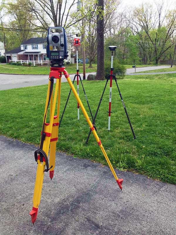
Dr. Helmke demonstrated Tech Fee surveying equipment including a Sokkia Laser Total
Station and Emlid Reach RS+ GPS receivers in his front yard (Figure 1). Dr. Helmke
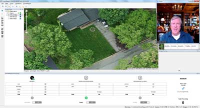
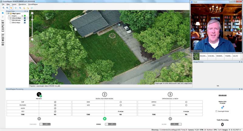
collected aerial images of his property with a drone and shared them with his class.
Using photogrammetry software, including Drone Mapper purchased by Tech Fee (Figure
2), his class produced photomosaic maps and 3-dimensional digital elevation models
of the study site. Although Dr. Helmke and his students would have enjoyed hands-on
training in the field, Tech Fee tools allowed the course objectives to be met and
prepared students for successful careers in the applied geosciences.
Although the field portion of the course was dropped due to the COVID-19 pandemic,
Dr. Helmke was able to train students on the use of cutting-edge technology provided
through Tech Fee. Using a combination of a Go-Pro camera and a remote Zoom session,
Dr. Helmke demonstrated Tech Fee surveying equipment including a Sokkia Laser Total
Station and Emlid Reach RS+ GPS receivers in his front yard (Figure 1). Dr. Helmke
collected aerial images of his property with a drone and shared them with his class.
Using photogrammetry software, including Drone Mapper purchased by Tech Fee (Figure
2), his class produced photomosaic maps and 3-dimensional digital elevation models
of the study site. Although Dr. Helmke and his students would have enjoyed hands-on
training in the field, Tech Fee tools allowed the course objectives to be met and
prepared students for successful careers in the applied geosciences.
Recent Posts
- Geographic Information Systems (GIS) Succes Story Moving to ESRI to the Cloud
- Earth and Space Sciences – Creating a remote Field Experience
- Moving SMD 501 Human Cadaver Anatomy lab to an on-line format
- Technology Updates for Classroom & Work Continuity
- Technology Update: New IS&T Initiatives Starting in January